
Groupes de coordination
| ID_GC | Intitulé | Pays | Région | Continent | Platform level | Referent Platform | Type | Members of the Coordination Group | Free field | Free terms | Actors members of the GC | Géolocation | Plat-form description | Article | pf_picture | Territory description | Résumé - processus | Support needs | Autres informations | Contacts | Validé | Current Well-being and eCO2 situation | Nos choix | Actor type | Créé le | dernière modif. | ||||||
|---|---|---|---|---|---|---|---|---|---|---|---|---|---|---|---|---|---|---|---|---|---|---|---|---|---|---|---|---|---|---|---|---|
| GC224017 | Tábua |  Portugal Portugal | Distrito de Coimbra | Europe | Territory of Coresponsibility | Coordination group composed under the Local Council of Social Action of Board, aiming to boost the SPIRAL metodolia and enter the same in the planning process | 547 | 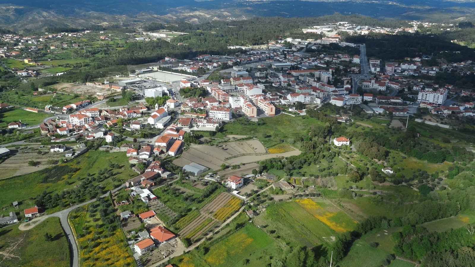 | Tábua é uma vila portuguesa no Distrito de Coimbra, região Centro e sub-região do Pinhal Interior Norte, com cerca de 2 700 habitantes. É sede de um município com 199,79 km² de área e 12 071 habitantes (2011), subdividido em 11 freguesias. O município é limitado a norte pelo município de Carregal do Sal, a este por Oliveira do Hospital, a sul por Arganil, a oeste por Penacova e a noroeste por Santa Comba Dão. | 2014-06-18 10:55 | 2017-10-04 09:50 | |||||||||||||||||||||
| GC157091 | Barreiro. | Portugal | Distrito de Setubal | Europe | Territory of Coresponsibility | The work has been started in early 2014 in the historical districts of Barreiro with an aim to improve the quality of life of the local population and the image of the district. | 526 |  | O Barreiro é uma cidade portuguesa no Distrito de Setúbal, com perto de 78 000 habitantes. É sede de um concelho com 36,39 km² de área e 78 764 habitantes (2011), subdividido em 4 freguesias. O município é limitado a leste pelo concelho da Moita, a sudeste por Palmela, a sul por Setúbal e Sesimbra, a oeste pelo Seixal e a norte pelo rio Tejo e o seu estuário. Na outra margem encontra-se a cidade de Lisboa. De salientar que a cidade do Barreiro apresenta uma posição estratégica a 6 km da Baixa Alfacinha. Banhada pelo rio Tejo e apoiada por um importante terminal rodo-ferro-fluvial, dista, por via terrestre, 20 km da cidade de Lisboa (pela Ponte 25 de Abril — 35 km pela Ponte Vasco da Gama) e cerca de 35 km de Setúbal, capital de distrito (pela A2). | 2014-02-17 09:30 | 2017-10-04 09:39 | |||||||||||||||||||||
| GC269156 | Grandola | Portugal | Distrito de Setubal | Europe | Territory of Coresponsibility | . | 845 |  | Grândola é uma vila portuguesa no Distrito de Setúbal, região (NUTS II) do Alentejo e sub-região (NUTS III) do Alentejo Litoral, com cerca de 6 800 habitantes. É sede de um município com 825,94 km² de área e 14 826 habitantes (2011), subdividido em 4 freguesias. O município é limitado a norte pelo município de Alcácer do Sal, a leste por Ferreira do Alentejo, a sul por Santiago do Cacém, a oeste pelo oceano Atlântico e a noroeste, através do Estuário do Sado, por Setúbal. | 2016-02-17 10:20 | 2017-10-04 09:36 | |||||||||||||||||||||
| GC277514 | Santiago do Cacém | Portugal | Distrito de Setubal | Europe | Territory of Coresponsibility | A Plataforma Multi-Atores é constituida pela Rede Social do Conselho de Santiago do Cacém. | 867 |  | Santiago do Cacém é uma cidade portuguesa no Distrito de Setúbal, região do Alentejo e sub-região do Alentejo Litoral, com uma população residente de 6 403 habitantes (2015 INE). O seu nome deriva do Governador Mouro Kassim e da Ordem de Santiago. É sede de um dos maiores municípios de Portugal, com 1 059,77 km² de área e 29 749 habitantes (2015 INE), subdividido em 8 freguesias. O município é limitado a norte pelo termo de Grândola, a nordeste por Ferreira do Alentejo, a leste por Aljustrel, a sul por Ourique e Odemira e a oeste por Sines e tem litoral no oceano Atlântico. É o único município de todo o Alentejo que contém 2 cidades dentro do seu termo. Mais interessante se torna o facto de possuir também 3 vilas. | 2016-06-08 07:02 | 2017-10-04 09:30 | |||||||||||||||||||||
| GC266043 | Setubal | Portugal | Distrito de Setubal | Europe | Territory of Coresponsibility | Territorio de coresponsablidade do Concelho de Setubal | 836 | 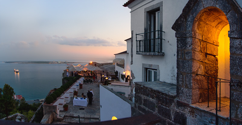 | Setúbal é uma cidade portuguesa, capital do distrito de Setúbal (desde 1926) e sede de diocese (desde 1975). Situa-se na sub-região de Área Metropolitana de Lisboa. É sede de um município com 230,33 km² de área e 131 000 habitantes (2011), subdividido em 5 freguesias. O município é limitado a oeste pelo município de Sesimbra, a noroeste pelo Barreiro, a norte e leste por Palmela e, a sul, o estuário do Sado separa-o dos municípios de Alcácer do Sal e Grândola. A península de Tróia, pertencente a Grândola, situa-se em frente da cidade, entre o estuário do Sado e o litoral do Oceano Atlântico. | 2015-12-15 15:54 | 2017-10-04 09:27 | |||||||||||||||||||||
| GC136736 | Paços de Ferreira | Portugal | Distrito do Porto | Europe | Territory of Coresponsibility | . | 470 |  | Paços de Ferreira é uma cidade portuguesa no Distrito do Porto, região de Entre Douro e Minho e sub-região do Vale do Sousa e Baixo Tâmega, com 9 085 habitantes (2011). É sede de um concelho com 70,99 km² de área e 56 340 habitantes (2011), subdividido em 12 freguesias. O município é limitado a leste pelo município de Lousada, a sul por Paredes, a sudoeste por Valongo e a oeste e norte por Santo Tirso. Até ao liberalismo constituía o Couto de Paços de Ferreira. Tornou-se concelho a 6 de Novembro de 1836, sucedendo ao concelho de Sobrosa, sendo a sede concelhia foi elevada ao estatuto de cidade em 20 de Maio de 1993. Industria O concelho de Paços de Ferreira exporta cerca de 400 milhões de euros/ano (Fonte INE), destacando-se no panorama nacional, graças à pujante industria de mobiliário e têxtil, tendo reduzido em cerca de metade a taxa de desemprego nos últimos 3 anos. | 2013-10-15 09:12 | 2017-10-04 09:25 | |||||||||||||||||||||
| GC262688 | Terras Dentro | Portugal | Distritos de Beja, Evora e Setubal | Europe | Territory of Coresponsibility | Criada em 1991, Terras Dentro é uma Associação de Desenvolvimento Local que tem uma área de intervenção abrangendo os concelhos de Alcácer do Sal, Alvito, Cuba, Portel, Montemor-o-Novo e Vidigueira, num total de 3.506,521 Km², com 43.221 habitantes. Created in 1991, Terras Dentro is a Local Development Association for a territory including Alcácer do Sal, Alvito, Cuba, Portel, Montemor-o-Novo and Vidigueira municipalities (Alentejo Region) | 829 |  | A Terras Dentro é uma associação para o Desenvolvimento Integrado com mais de 25 anos de existência em prol do desenvolvimento das comunidades e da melhoria da qualidade de vida das populações. | 2015-10-21 14:48 | 2017-10-04 09:20 | |||||||||||||||||||||
| GC251196 | Câmara de Lobos | Portugal | Madeira | Europe | Territory of Coresponsibility | Câmara de Lobos é o primeiro territorio de coresponsabilidade da Madeira. | 817 |  | Câmara de Lobos é município português na ilha da Madeira, Região Autónoma da Madeira, com sede na cidade e freguesia homónima. Tem 52,15 km² de área e 35 666 habitantes (2011), subdividido em 5 freguesias. O município é limitado a norte pelo município de São Vicente, a nordeste por Santana, a leste pelo Funchal e a oeste pela Ribeira Brava, sendo banhado pelo oceano Atlântico a sul. A cidade tem 17 986 habitantes. | 2015-06-04 15:54 | 2017-10-04 09:01 | |||||||||||||||||||||
| GC123202 | Caminha | Portugal | Distrito de Viana do Castelo | Europe | Territory of Coresponsibility | . | 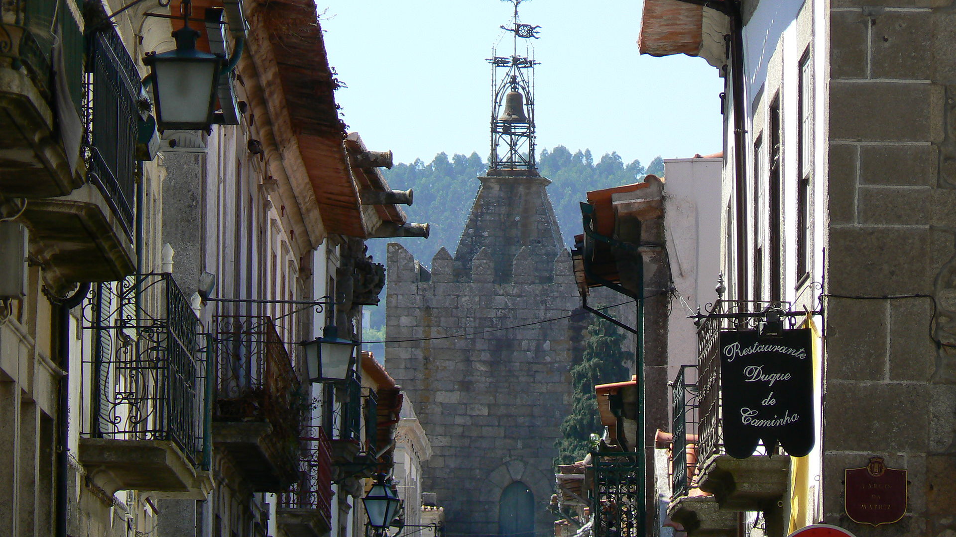 | Caminha é uma vila raiana portuguesa no Distrito de Viana do Castelo, região Norte e sub-região do Minho-Lima, com cerca de 2 500 habitantes. É sede de um município com 136,52 km² de área e 16 684 habitantes (2011), subdividido em 14 freguesias. O município é limitado a nordeste pelo município de Vila Nova de Cerveira, a sudeste por Ponte de Lima, a sul por Viana do Castelo, a norte pela Galiza e a oeste pelo Oceano Atlântico. A foz do rio Minho situa-se em Caminha, fazendo este rio parte integrante da paisagem da vila. Para atravessá-lo rumo à vizinha Galiza, existe um terminal fluvial de barcos, que transportam não só passageiros, mas também automóveis. | 2013-04-26 09:08 | 2017-10-04 08:41 | ||||||||||||||||||||||
| GC123203 | Melgaço | Portugal | Distrito de Viana do Castelo | Europe | Territory of Coresponsibility | . |  | Melgaço é uma vila raiana portuguesa no Distrito de Viana do Castelo, região do Norte e sub-região do Minho-Lima, com cerca de 1 500 habitantes. É sede de um concelho com 238,25 km² de área e 9 213 habitantes (2011), subdividido em 13 freguesias. O município é limitado a norte e leste pela Espanha, a sudoeste pelo município de Arcos de Valdevez, e a oeste por Monção. É o município mais setentrional do país. O ponto mais elevado do concelho situa-se no Giestoso, com 1 335 metros de altitude, na freguesia de Castro Laboreiro. Em Melgaço existe toda uma tradição de contos e fábulas com criaturas fantásticas como arganões e outros seres com poderes mágicos. Esta cultura popular foi sendo transmitida oralmente ao longo de gerações, estando atualmente em declínio. | 2013-04-26 09:08 | 2017-10-04 08:39 | ||||||||||||||||||||||
| GC123204 | Monção | Portugal | Distrito de Viana do Castelo | Europe | Territory of Coresponsibility | . |  | Monção é uma vila raiana portuguesa no Distrito de Viana do Castelo, região do Norte e sub-região do Minho-Lima, com cerca de 2 500 habitantes. É sede de um município com 211,31 km² de área e 19 230 habitantes (2011), subdividido em 24 freguesias. O município é limitado a norte por Salvaterra do Minho (Galiza) e Arbo (Galiza), a leste pelo município de Melgaço, a sul por Arcos de Valdevez, a sudoeste por Paredes de Coura e a oeste por Valença. O ponto mais alto do concelho no alto de S. António de Vale dos Poldros, com 1 114 metros de altitude, na freguesia de Riba de Mouro. Está localizado a dois quilómetros do município galego de Salvaterra do Minho, ao qual está ligado por uma ponte sobre o rio Minho. | 2013-04-26 09:08 | 2017-10-04 08:31 | ||||||||||||||||||||||
| GC123205 | Paredes de Coura | Portugal | Distrito de Viana do Castelo | Europe | Territory of Coresponsibility | . |  | Paredes de Coura é uma vila portuguesa no Distrito de Viana do Castelo, região do Norte e sub-região do Minho-Lima. É sede de um município com 138,19 km² de área e 9 198 habitantes (2011), subdividido em 16 freguesias. O município é limitado a norte pelos municípios de Valença e Monção, a leste por Arcos de Valdevez, a sul por Ponte de Lima e a oeste por Vila Nova de Cerveira. O ponto mais alto do concelho situa-se no Corno do Bico, com 883 metros de altitude, na área da paisagem protegida com o mesmo nome. | 2013-04-26 09:09 | 2017-10-04 08:28 | ||||||||||||||||||||||
| GC123206 | Ponte da Barca | Portugal | Distrito de Viana do Castelo | Europe | Territory of Coresponsibility | . |  | Ponte da Barca é uma vila portuguesa no Distrito de Viana do Castelo, região Norte e sub-região do Minho-Lima, com cerca de 2 300 habitantes. É sede do concelho de mesmo nome com 184,76 km² de área e 12 061 habitantes (2011), subdividido em 17 freguesias. O concelho é limitado a norte pelo concelho de Arcos de Valdevez, a leste pela Espanha, a sul por Terras de Bouro e Vila Verde e a oeste por Ponte de Lima. Deve o seu topónimo à "barca" que fazia a ligação entre as duas margens do Rio Lima, muitas vezes peregrinos a caminho de Santiago de Compostela, sendo a "ponte" construída em meados do século XIV que lhe vai dar o nome de S.João de Ponte da Barca (1450). O ponto mais alto do concelho situa-se em plena Serra Amarela, no alto da Louriça, com 1 359 metros de altitude, na freguesia do Lindoso. Desta terra é oriunda a mãe de Santo António de Lisboa, Teresa Taveira, nascida na Casa do Paço, freguesia de Lavradas; bem como o navegador Fernão de Magalhães, da nobre família do Paço Vedro (freguesia de Magalhães). | 2013-04-26 09:09 | 2017-10-03 09:55 | ||||||||||||||||||||||
| GC123207 | Ponte de Lima | Portugal | Distrito de Viana do Castelo | Europe | Territory of Coresponsibility | . | 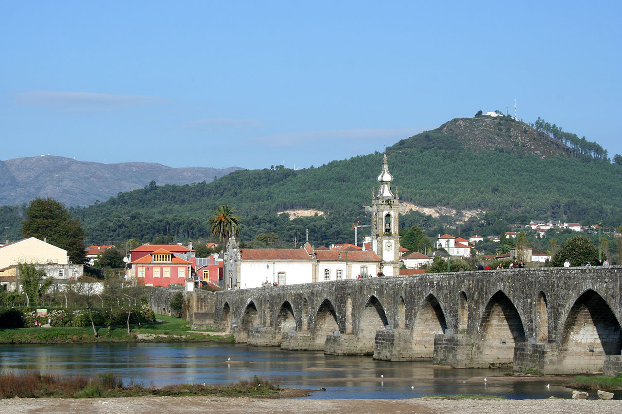 | Ponte do Lima é uma vila portuguesa no Distrito de Viana do Castelo, região do Norte e sub-região do Minho-Lima, com cerca de 5125 habitantes. É caracterizada pela sua arquitetura medieval e pela área envolvente, banhada pelo Rio Lima. É a vila mais antiga de Portugal. É sede de um município com 320,25 km² de área e 43 498 habitantes (2011), subdividido em 39 freguesias, cujo presidente da Câmara Municipal é Victor Mendes. O município é limitado a norte pelo município de Paredes de Coura, a leste por Arcos de Valdevez e Ponte da Barca, a sueste por Vila Verde, a sul por Barcelos, a oeste por Viana do Castelo e Caminha e a noroeste por Vila Nova de Cerveira. Localidade muito importante desde a era Romana, possuiu um Palácio da Corte do Reino de Leão, documentado por achados arqueológicos e outros documentos escritos. | 2013-04-26 09:09 | 2017-10-03 09:50 | ||||||||||||||||||||||
| GC123208 | Valença | Portugal | Distrito de Viana do Castelo | Europe | Territory of Coresponsibility | . |  | Valença (por vezes dita Valença do Minho) é uma cidade raiana portuguesa no Distrito de Viana do Castelo, região Norte e sub-região do Alto Minho. Valença foi outrora sede de bispado. É sede de um município com 117,13 km² de área e 14 127 habitantes (2011), subdividido em 11 freguesias. O município é limitado a leste pelo município de Monção, a sul por Paredes de Coura, a oeste por Vila Nova de Cerveira e a noroeste e norte pela Galiza (município de Tui). Recebeu foral de D. Sancho I, sendo então designada de Contrasta. Mudou para o actual nome em 1262. É designada por vezes por Valença do Minho. Foi elevada a cidade em 12 de Junho de 2009. | 2013-04-26 09:10 | 2017-10-03 09:47 | ||||||||||||||||||||||
| GC123209 | Viana do Castelo 1 - Meadela | Portugal | Distrito de Viana do Castelo | Europe | Territory of Coresponsibility | . |  | Meadela - Viana do Castelo The parish of Meadela in which this project develops, is situated in the urban expansion zone of the city Viana do Castelo (district capital), with an occupation area of 7,5 km of the 29,7 km total. This parish has a total of 9.782 inhabitants and it’s a heterogeneous population, as consequence of the rupture with the rural way of living, presenting transition features from rural to urban spaces. It is recognized as one of the parish that has a bigger group of children and young from 0 to 24 years of age (2685 individuals - 27% of its total) compared to other parish, which gives a special attention to all social institutions that work in that territory. The rich cultural heritage and associative dynamism is considered one of the most recognizable features. This parish has a modern set of social and educational facilities, which provide good support to all those who have recourse to them, as social cohesion too. With a modern industrial park functioning in its limits, Meadela is close to major road structures, with easy access to major cities like Oporto. Nowadays Meadela integrates a parish association (along with other two), but maintaining its historic and social identity. | 2013-04-26 09:11 | 2017-10-03 09:43 | ||||||||||||||||||||||
| GC123210 | Viana do Castelo 2 - Santa Leocádia | Portugal | Distrito de Viana do Castelo | Europe | Territory of Coresponsibility | . |  | Viana do Castelo é uma cidade portuguesa - com 38 045 habitantes - situada no Distrito de Viana do Castelo, na Região Norte, e integrada na sub-região NUT III do Minho-Lima. A cidade é atualmente constituída pela União de Freguesias de Santa Maria Maior, Monserrate e Meadela, e os seus subúrbios estendem-se até às freguesias de Areosa e Darque. É sede de um município - com 319,02 km² de área e 88 725 habitantes (2011) - subdividido em vinte e sete freguesias. O concelho é limitado a norte pelo município de Caminha, a leste por Ponte de Lima, a sul por Barcelos e Esposende, e a oeste pelo Oceano Atlântico.
| Pertence à rede das Cidades Cittaslow. | 2013-04-26 09:11 | 2017-10-03 09:39 | |||||||||||||||||||||
| GC123211 | Vila Nova de Cerveira | Portugal | Distrito de Viana do Castelo | Europe | Territory of Coresponsibility | . |  | Vila Nova de Cerveira (conhecida frequentemente apenas por Cerveira) é uma vila portuguesa no Distrito de Viana do Castelo, região do Norte e sub-região do Minho-Lima, com cerca de 1 400 habitantes. É sede de um município com 108,47 km² de área e 9 253 habitantes (2011), subdividido em 11 freguesias. O município é limitado a nordeste pelo município de Valença, a leste por Paredes de Coura, a sueste por Ponte de Lima, a sudoeste por Caminha e a noroeste pela Galiza (concelhos do Rosal e Tomiño). | 2013-04-26 09:11 | 2017-10-03 09:25 | ||||||||||||||||||||||
| GC111433 | Covilha | Portugal | Distrito de Castelo Branco | Europe | Territory of Coresponsibility | Covilhã is a city in the centre of Portugal, which combines a thousand year history with a historic textile industry. Situated near the highest mountain of the country, this particular location makes Covilhã the ‘Mountain City’ of Portugal. The city of Covilhã has developed an important effort to find ways to solve new and old forms of poverty and social exclusion. With the TOGETHER Project, the goal will be to get a sense of a shared vision of welfare, reflecting on the problems experienced and invite people to participate actively in the process, sharing knowledge and looking for activities that contribute to their collective welfare. The program ‘Social Network’ and its intervention in social matters, will find new ways to solve problems though the implementation and development of the methology presented by the Project. The main challenges of the Municipality are : - reconverting its economic basis and developing new technology-based activities - coping with the aging of the population and its dissemination on in rural areas - improving the quality of housing and developing social housing in order to answer the needs of young generations. |  | A Covilhã DmC • GCMAI é uma cidade portuguesa pertencente ao Distrito de Castelo Branco, à Região Centro, à sub-região da Cova da Beira e à antiga província da Beira Baixa. É porta da Serra da Estrela e tem 36 356 habitantes no seu perímetro urbano formado por cinco freguesias: Covilhã e Canhoso, Teixoso e Sarzedo, Cantar-Galo e Vila do Carvalho, Boidobra e Tortosendo. É sede de um município com 555,60 km² de área e 51 797 habitantes (2011), subdividido em 21 freguesias. O município é limitado a norte pelos municípios de Seia e Manteigas, a nordeste pela Guarda, a leste por Belmonte, a sul pelo Fundão e a oeste por Pampilhosa da Serra e Arganil | 2012-11-22 04:14 | 2017-10-03 09:18 | ||||||||||||||||||||||
| GC241343 | Vila de Rei | Portugal | Distrito de Castelo Branco | Europe | Territory of Coresponsibility | Vila de Rei é uma vila portuguesa no Distrito de Castelo Branco. Ela busca se afirmar como um território de referência nacional e europeia, no que concerne à Co-Responsabilidade para o Bem-Estar de todos. | 620 | 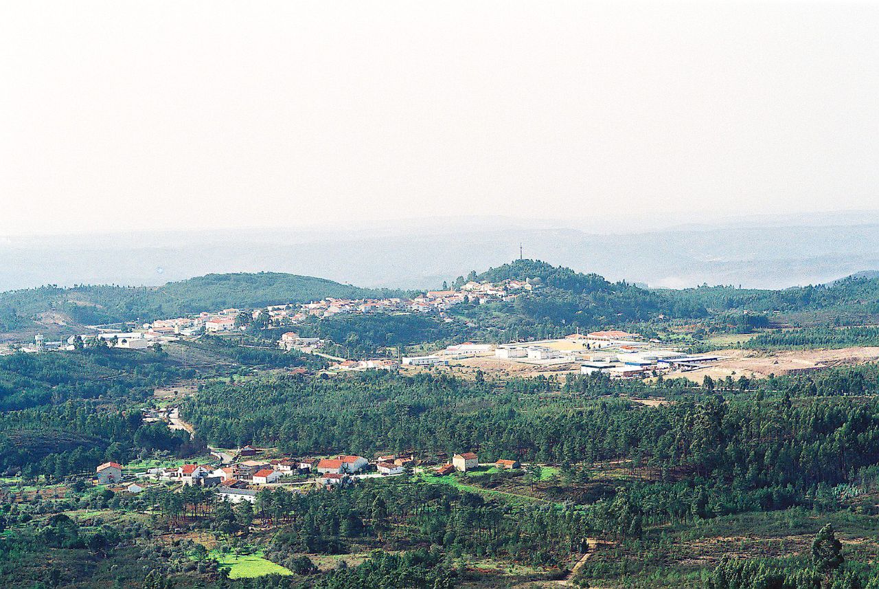 | Vila de Rei é uma vila portuguesa pertencente ao Distrito de Castelo Branco, região Centro e sub-região do Pinhal Interior Sul, com cerca de 2 497 habitantes. É sede de um município com 191,55 km² de área e 3 452 habitantes (2011), subdividido em 3 freguesias. O município é limitado a norte pelo município da Sertã, a leste por Mação, a sul pelo Sardoal e por Abrantes e a oeste por Ferreira do Zêzere. A cerca de 2 km encontra-se o Centro Geodésico de Portugal Continental, na Serra da Melriça. No alto desta serra, encontra-se construído um marco com cerca de 20 metros de altura, denominado de "Picoto", marcando assim o Centro a nível de coordenadas geodésicas. | 2014-11-05 11:32 | 2017-10-03 09:10 | |||||||||||||||||||||
| GC136529 | Cascais | Portugal | Distrito de Lisboa | Europe | Territory of Coresponsibility | Cascais is a city on the west coast of Lisbon. Its coordination group is the social network. | 463 | 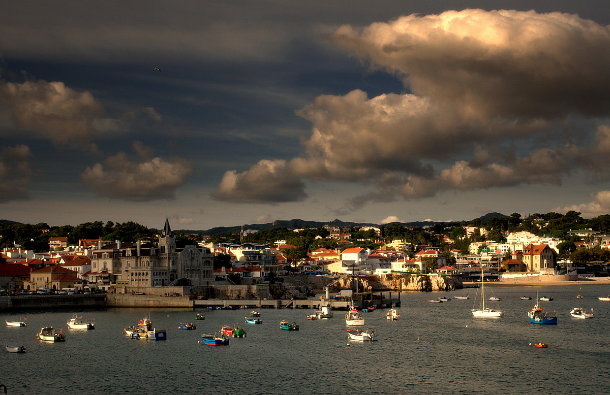 | Cascais MHC é uma vila portuguesa no Distrito de Lisboa, região de Lisboa e sub-região da Grande Lisboa, com cerca de 209 869 habitantes. É sede de um município com 97,40 km² de área e 206 479 habitantes (2011), subdividido em 4 freguesias. A sua criação data da Carta da Vila, de 7 de junho de 1364, na qual o rei D. Pedro I a decreta como vila, desanexando-a do termo de Sintra. | 2013-10-07 13:04 | 2017-10-03 09:07 | |||||||||||||||||||||
| GC136737 | Loures | Portugal | Distrito de Lisboa | Europe | Territory of Coresponsibility | Loures is a city located just on the north border of the Capital in its surroundings. In Loures SPIRAL approach has been developped with young people in the framework of the projet "Young people in Loures: Happy citizens" | 471 |  | Loures é uma cidade portuguesa no Distrito de Lisboa, região de Lisboa e sub-região da Grande Lisboa, com cerca de 26 000 habitantes. É sede de um município com 167,24 km² de área e 205 054 habitantes (2013), subdividido em 10 freguesias. O município é limitado a norte pelo município de Arruda dos Vinhos, a leste por Vila Franca de Xira e pelo estuário do Tejo (território oficialmente atribuído também a Vila Franca de Xira), a sudeste por Lisboa, a sudoeste por Odivelas, a oeste por Sintra e a noroeste por Mafra. | 2013-10-15 09:14 | 2017-10-03 09:04 | |||||||||||||||||||||
| GC118254 | Sintra | Portugal | Distrito de Lisboa | Europe | Territory of Coresponsibility | Sintra dispoe de uma Rede Social (Plataforma Multi-Atores) desde ... Conseguiu aplicar a metodologia SPIRAL a larga escala graças a formações de um grande numero de técnicos, o que permitiu multiplicar os grupos homogéneos. Ideia que foi desde então integrada na propria metodologia SPIRAL. | 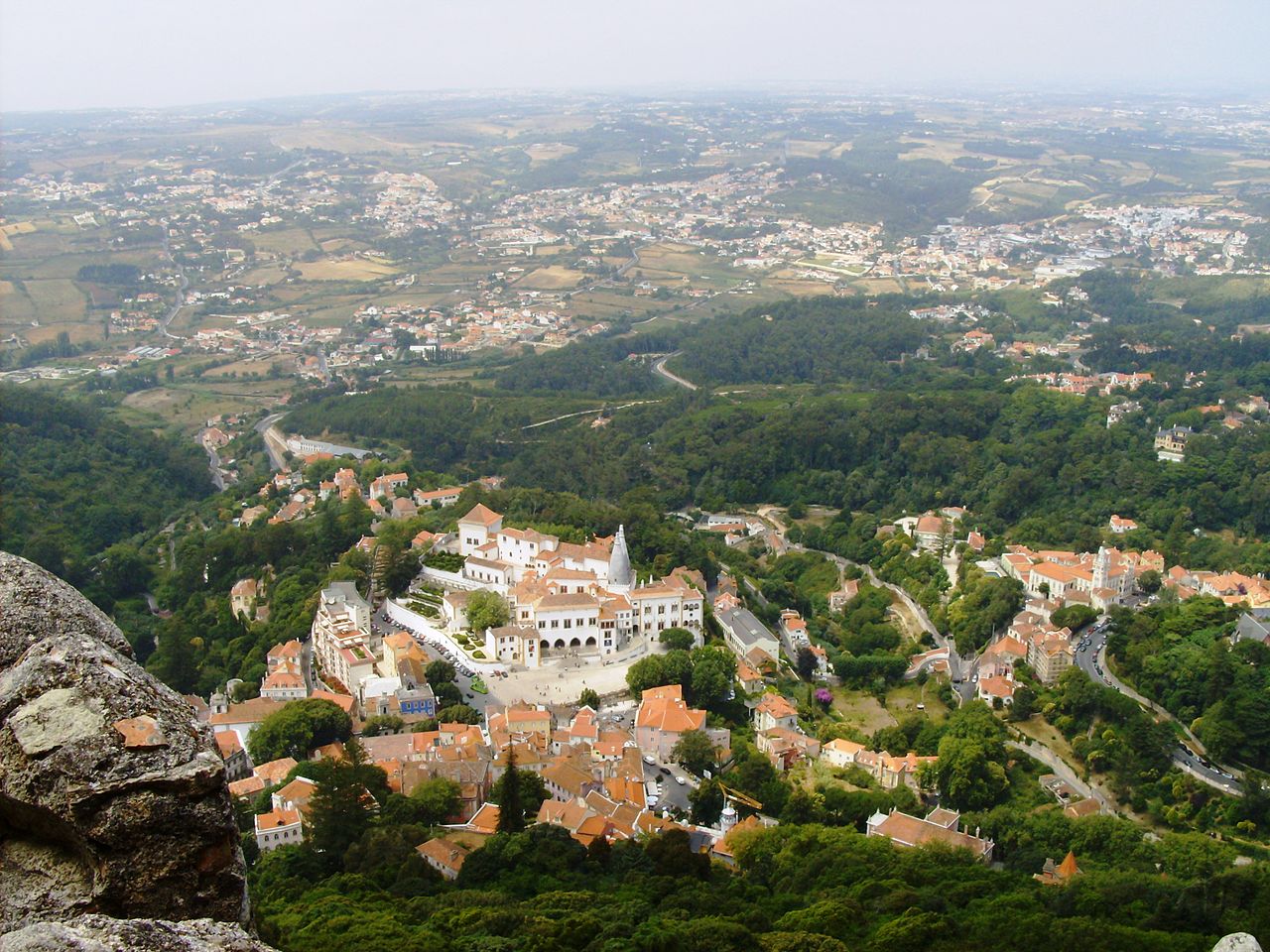 | Sintra é uma vila portuguesa no Distrito de Lisboa, na região de Lisboa, sub-região da Grande Lisboa e na Área Metropolitana de Lisboa. É sede de um município com 319,23 km² de área e 381 728 habitantes (2015), subdividido em 11 freguesias. O município é limitado a norte pelo município de Mafra, a leste por Loures, Odivelas e Amadora, a sudeste por Oeiras, a sul por Cascais e a oeste pelo oceano Atlântico. É a vila de Portugal com mais habitantes, seguida de Cascais e Oeiras (Portugal). Esta região também é conhecida como Riviera Portuguesa. | 2013-02-26 13:42 | 2017-10-03 09:00 | ||||||||||||||||||||||
| GC123201 | Arcos de Valdevez | Portugal | Distrito de Viana do Castelo | Europe | Territory of Coresponsibility | . | 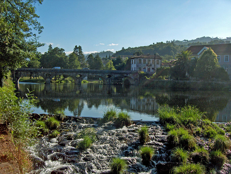 | Arcos de Valdevez é uma vilaraianaportuguesa no Distrito de Viana do Castelo, região Norte e sub-região do Minho-Lima, com cerca de 22 000 habitantes. | 2013-04-26 09:07 | 2017-10-03 08:53 | ||||||||||||||||||||||
| GC76078 | Hannover |  Allemagne Allemagne | Niedersachsen - Lower Saxony | Europe | Territory of Coresponsibility | . | 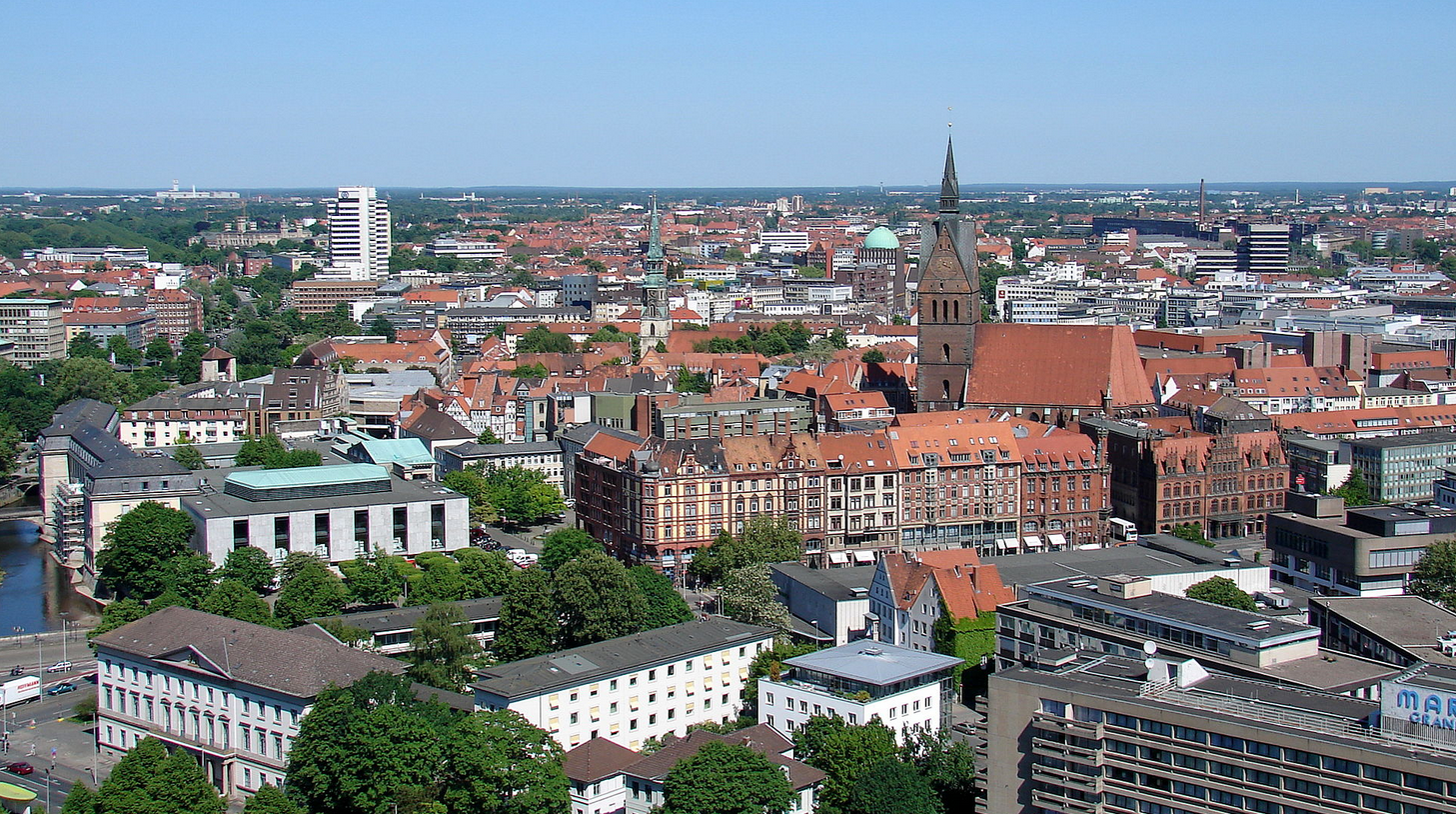 | Hannover, on the River Leine, is the capital of the federal state of Lower Saxony (Niedersachsen). With a population of 518,386, Hannover is a major centre of Northern Germany. Hanover appears as a modern city. The city counts important cultural developments, good businesses and remarkable interregional events. | 2012-11-13 23:59 | 2017-09-28 11:10 | ||||||||||||||||||||||
| GC111429 | Kavala |  Grèce Grèce | Anatoliki Makedonia - Aνατολικη Mακεδονια | Europe | Territory of Coresponsibility | By participating in the TOGETHER project, the Municipality focuses on establishing a network of its social services along with some of the more active local NGOs. The main challenges are:
| 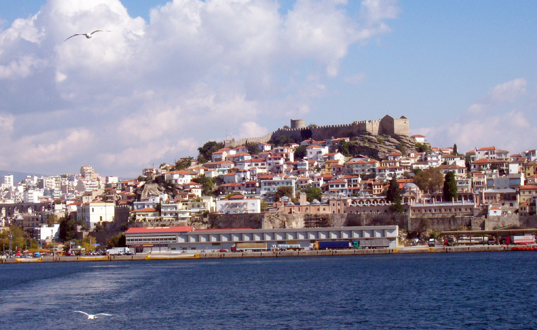 | The city of Kavala is located in the North of Greece, in the region of East Macedonia & Thrace. Kavala is a seaside city with 85 000 inhabtiatns, not far from the Bulgarian border and from Turkey. The Municipality of Kavala is the 2nd biggest commercial port in the North. Besides being considered one of the major fishery centres in Greece, Kavala has a leading role in the local economy, as well as in the industrial economy sector. | 2012-11-22 04:13 | 2017-09-28 11:08 | ||||||||||||||||||||||
| GC111430 | Pergine |  Italie Italie | Trento - Autonomous Province | Europe | Territory of Coresponsibility | The aim of the City of Pergine is to use the methodology of coresponsibility in order to test and integrate an existing Social Plan. The Local Support Group works on promoting the active participation of the citizens and believe that this new approach will further spread all over the Province. The main challenges of the city are :
|  | Pergine Valsugana is a municipality of the Autonomous Province of Trento in North-Eastern Italy. The city is the youngest municipality of Italy, with a strong historical tradition of cooperation, many cooperatives in agriculture, industry and handcraft and in social services. | 2012-11-22 04:13 | 2017-09-28 11:03 | ||||||||||||||||||||||
| GC220827 | Novellara | Italie | Emilia Romagna | Europe | Territory of Coresponsibility |
. | 530 |  | Novellara is a town and comune in the province of Reggio Emilia, Emilia-Romagna, Italy, with some 13,500 inhabitants. In addition to this, Novellara is also home to the second largest Gurdwara in Europe. This reflects the presence of a very large Sikh community, living in Novellara and nearby places, where they work mainly in cattle farms and dairies. As in other towns of the region, (e.g. Bologna), streets are lined with characteristic arcades, intended to offer shade in summer and shelter from rain or snow. | 2014-03-22 12:18 | 2017-09-28 10:59 | |||||||||||||||||||||
| GC266355 | Chieri | Italie | Piemonte | Europe | Territory of Coresponsibility | Le groupe se réunit depuis 2011. Le groupe "Chieri c'è" a placé dans la Mairie une conseillère et un adjoint. Voir le site http://www.chierice.it | 837 | 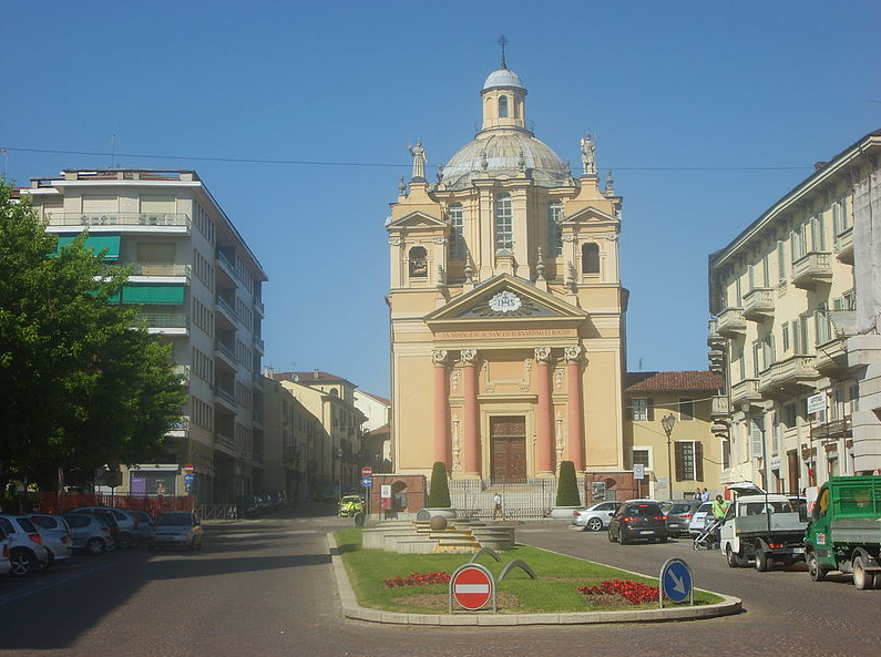 | Chieri est une ville italienne de 37.000 habitants. Le groupe Chieri c'è est en train de créer un réseau sur les suujets qui suivent: Bien communs, nourriture, mobilité urbaine. | Le grand sujet des biens communs (commons) a été aussi pris en charge par l'administration communale avec un "Festival intarnazionale dei beni comuni" qui s'est déroulé de 9 à 12 juillet 2015. Une grande usine de 32.000 metres carrés est le plus grand thème des commons à Chieri, mais aussi les anciens dépots militaires. | 2015-12-22 16:31 | 2017-09-28 10:56 | ||||||||||||||||||||
| GC111431 | Salaspils |  Lettonie Lettonie | Latvia | Europe | Territory of Coresponsibility | The municipality intends to engage in this process in order to define social inclusion and well-being of all, largely involving the different parts of the population, especially those people suffering from the risk of social exclusion, such as the unemployed, poor families, students, the elderly, large families and single mothers. | 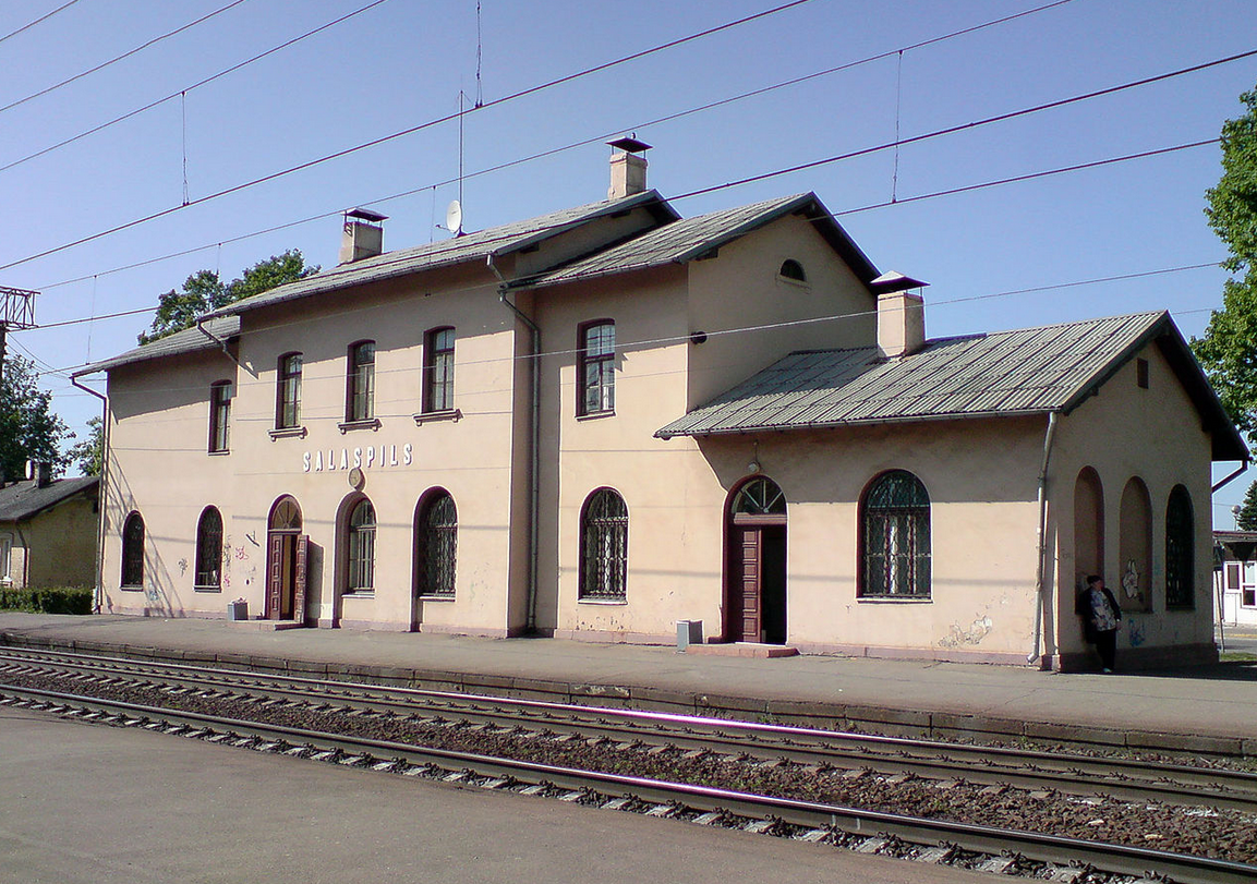 | Salaspils is a town in Latvia, the administrative centre of Salaspils municipality. The town is situated on the northern bank of the Daugava River 18 kilometres to the south-east of the city of Riga. During the late 1950s and early 1960s, various industrial enterprises and governmental institutions developed in Salaspils, such as the nuclear plant and four branches of the Academy of Science. Large multi-storied housing blocks appeared to house incoming power plant workers, many of whom were Russians. In a few decades Salaspils transformed from a very peaceful rural settlement to a mikroraion-style town. Due to the rapid development, Soviet authorities ordered construction of the Riga HES and Riga TEC-2. The dam created a massive reservoir that flooded monuments of Salaspils ancient history. The last unsubmerged sections of old Salaspils have been preserved at Salaspils railway station. Salaspils Municipality is situated in the central part of Latvia, on the periphery of the capital Riga. The town is surrounded by a rural area and its history is closely related to the Riga hydroelectric station, that literally contributed to its birth. | The main challenges of the Municipality in this project are:
| 2012-11-22 04:14 | 2017-09-28 10:50 | |||||||||||||||||||||
| GC111432 | Debica |  Pologne Pologne | Podkarpatskie | Europe | Territory of Coresponsibility | Dębica’s participation in the project TOGETHER aims at :
|  | Dębica is a town in southeastern Poland with 46,693 inhabitants, as of 2 June 2009. It is the capital of Dębica County. Since 1999 it has been situated in the Podkarpackie Voivodeship; it had previously been in the Tarnów Voivodeship (1975–1998). Dębica belongs to the historic province of Lesser Poland, and for centuries it was part of the Sandomierz Voivodeship. Since the mid-1930s, Dębica, in spite of its size, has been an important industrial centre of Poland. There are several companies located in the town and its proximity. The city of Dębica, is a modern town with 47000 inhabitants which combines the charm of history with its industrial character. Well located between Germany and Ukraine, Dębica plays an important role in domestic and international communications system. The most important part of the active population (mainly young people) work in sectors of industry and construction. Despite this, unemployment affects around 25% of young people. | 2012-11-22 04:14 | 2017-09-28 10:35 | ||||||||||||||||||||||
| GC270903 | Hénnebont |  France France | Bretagne | Europe | Territory of Coresponsibility | La plateforme a été longue à constituer car la volonté de la ville était au départ de faire appel au monde associatif représentant la commune (cf. note de septembre en annexe). Une 1ere réunion s’est tenue le 19 septembre 2016 mais seules 2 personnes étaient présentes et une excusée. Malheureusement le monde associatif n’a pas répondu à nos sollicitations tout comme les entreprises, établissements scolaires ou comités d’entreprise. Nous avons donc présenté le projet dans les quatre conseils de quartiers (EVAQ) et au conseil citoyen. Un appel à participation est paru dans la presse et le magazine municipal (cf. annexes). Des volontaires se sont manifestés et une nouvelle réunion de mise en place de la plateforme a été organisée le 9 novembre. Cette plateforme est constituée de 11 personnes plus M. Pondaven (élu en charge du dossier) et Laetitia Hello (service municipal en charge du dossier). Nous avons donc 4 hommes et 9 femmes La moyenne d’âge est de 45 ans sachant que la plus jeune doit avoir 25 environ et le plus âgé 65 ans. La moitié des participants est issue du quartier prioritaire et l’autre moitié du reste de la commune et de différents quartiers. La moitié a une activité professionnelle (indépendant, salarié, fonctionnaire…) et l’autre moitié sans emploi car au chômage, au foyer ou en retraite. Lors des premières réunions, une personne âgée handicapée s’est jointe au groupe mais elle a cessé d’y venir car les réunions étaient trop difficiles pour elle dans le sens où, étant malvoyante, les documents n’étaient pas adaptés. Une autre personne du groupe l’aidait mais elle a souhaité arrêter. | 847 |  | Située entre mer et campagne, ancienne ville-pont sur le Blavet, porte médiévale du réseau des canaux bretons, Hennebont, chef-lieu de canton, fortifiée au XIIIe siècle, offre le charme d’une ville de 16 000 habitants, riche de son passé, de ses traditions. Assise sur les bords du Blavet qui subit l’influence des marées, à quelque 10 kilomètres en amont de son estuaire, Hennebont, Ville historique en Bretagne, ville fleurie, dévoile ses charmes de part et d’autre du fleuve ponctué d’écluses. A pied, à vélo, à cheval ou sur l’eau, découvrez ses circuits de randonnée et son patrimoine allant des grands monuments avec ses remparts et sa basilique, jusqu’aux ensembles urbains, en passant par le petit patrimoine bâti et naturel. Son Haras National et l’Espace Découverte du Cheval méritent le détour. À ne pas manquer le marché le jeudi matin.
| 2016-03-04 13:52 | 2017-09-28 09:41 | |||||||||||||||||||||
| GC289691 | Tests |  Autre Autre | Test | Other | NonValidated | Test description Test
| 2017-06-01 16:04 | 2017-06-01 16:08 | ||||||||||||||||||||||||
| GC281259 | Test new infopages | France | Pays de la Loire | Europe | NonValidated | Île d'Yeu (French pronunciation: il djø) is an island and commune just off the Vendée coast of western France. The island's two harbours, Port-Joinville in the north and Port de la Meule, located in a rocky inlet of the southern granite coast, are famous for the fishing of tuna and lobster. Test Administratively, the commune of L'Île-d'Yeu (with that spelling) forms part of the Vendée department and the Pays de la Loire region of France. The island is reached by ferry from Fromentine or Saint-Gilles-Croix-de-Vie. Air transportation is available at Île d'Yeu Aerodrome (IATA: IDY, ICAO: LFEY), with commercial service from Nantes Airport. |  | Neolithic markings in the native stone and an unusual concentration of megalithic dolmens and menhirs attest to the island's early sanctity.1 Irish monks from Bangor, County Down, dedicated their monastery on the Île d'Yeu to Hilaire; Saint Amand, from Poitou received early training there, but it was destroyed by Viking raiders in the ninth century. During the tenth century, monks from Marmoutier near Tours and monks of Saint-Cyprien at Poitiers built a new monastery and dedicated it to Saint Stephen. The castle built on an islet linked to the coast by a bridge is first mentioned in 1356. Since the nineteenth century Île d'Yeu has attracted many artists. Jean Rigaud (1912–1999), official painter to the French Navy, had a house there, as did Maurice Boitel (1919–2007). Jean Dufy (1888-1964) l made about twenty paintings of l'Ile d'Yeu during several summer stays between 1926 and 1930. The proclaimed hero of Verdun and the leader of France's wartime collaborationist Vichy régime, Philippe Pétain, died in prison on the island in 1951 and is buried there. The poet Marc-Adolphe Guégan, an early French exponent of haiku, lived on the island until his death in 1959.
The island's seaweeds have been the subject of studies by the French marine biologist Françoise Ardré.
| The Vieux-château de l'île d'Yeu ("Old castle of the Isle of Yeu") is a fortification île d'Yeu off the French Atlantic coast in the département of Vendée Olivier IV de Clisson, a great builder of castles, undertook the work with the aim of protecting the islanders in the event of foreign invasion. The longest of these had been led by the famous English pirate, Robert Knolles, who managed to seize the castle in 1355 and occupied the island for 37 years. In 1381, the île d'Yeu was retaken during the reconquest of Poitou by Olivier V de Clisson Test During the Renaissance, Jean V de Rieux, master of the isle, erected towered walls around the castle. This type of construction was carried out by Italian engineers brought back from the Italian Wars by King Francis I. This protection proved effective in 1550 when several thousand Spanish soldiers attacked from the north. Held in check under the walls by the local garrison, they were forced to retreat by sea to the Iberian peninsula.
Later, Vauban perfected this style of military architecture for his famous forts. The Vieux-château, made obsolete by the construction between (1654 and 1660) of small coastal forts following Vauban's technique, was demolished at the end of the 17th century, along with several other ancient castles on the French coast, by order of Louis XIV, worried that they could be taken by an enemy and used as strong points. The Vieux-château de l'Île d'Yeu has been classified as a Monument historique (Historic monument) since 1890.
Hergé was inspired by the Vieux-château in the design of The Adventures of Tintin comic The Black Island. | Localisation Port-Joinville, situé sur la côte nord-est de l’île d'Yeu, accueille les ferrys en provenance de Fromentine-La Barre-de-Monts (pour 60 % d'entre eux), La Fosse-Barbâtre (Île de Noirmoutier) ou Saint-Gilles-Croix-de-Vie. En 2006, 746000 passagers ont emprunté son embarcadère1. Toponymie Port Joinville s'est d'abord appelé "Port aux Bretons", puis "Port Breton" du fait que les marins bretons trouvaient là un refuge en haute mer dans une zone poissonneuse et y faisaient leur pose et leur ravitaillement avant de partir au loin ou de rejoindre leurs ports d'attache en Bretagne.
Au XVIIème siècle, en 1658, le port se voit offrir d'importants travaux d'extension et un creusement afin de recevoir des navires allant jusqu'à 200 tonneaux à la demande de Jeanne-Pélagie de Rieux d'Assérac et surtout de l'intendant du Roi Louis XIV, Fouquet, qui en contribuant à sécuriser l'ile et le port, nourrissait ses propres projets. C'est ainsi que Port Breton s'est appelé un temps "Port-Pélagie" en hommage à Jeanne-Pélagie de Rieux d'Assérac. Puis il est baptisé au moment de la Révolution, "Port-de-la-Sans-Culotterie", avant de devenir définitivement "Port Joinville" le 4 février 1846, en remerciement à François-Philippe de Joinville qui avait fait construire les quais de la Chapelle et le brise-lames, et amélioré les défenses militaires. Le brise-lames avait lui-même été edifié quelques années auparavant par des travaux qui durèrent de 1834 à 1843, pour protéger des courants de nord-est l'entrée du port tandis que l'estacade en forme de passerelle encadrant en parallèle la passe fut construite de 1880 à 1883 pour remplacer des tourelles de halage du coté est. Histoire Jusqu'au XVIIe siècle, seul un petit port naturel existait, protégé par deux jetées de pierre. Il était apprécié comme étape entre Bordeaux et les ports du Nord, particulièrement par les marins bretons, d’où son nom de « Port aux Bretons » puis, plus tard, de « Port-breton » Au XVIIe siècle, un nouveau quai fut construit. En 1846, le port fut rebaptisé Port-Joinville en l’honneur de François d'Orléans, prince de Joinville, qui avait contribué à son développement. Au XXe siècle, s’ajoutèrent un bassin, un port de pêche moderne et un port de plaisance. Depuis 2005, des catamarans peuvent être mouillés à côté de la gare maritime. | XXe siècle Aménagements du port... Le 19 février 1973, à 2 heures du matin, le cercueil du maréchal Pétain est enlevé par des membres d'un commando d’extrême-droite commandité par Jean-Louis Tixier-Vignancour (celui-ci n'étant pas présent sur les lieux) ; cet avocat célèbre, ancien candidat à l'élection présidentielle (1965) et sympathisant de l’OAS, avait monté cette opération dans le but de transférer la dépouille du Maréchal Pétain à l'ossuaire de Douaumont (Verdun). Ce transfert correspondait à un souhait de Pétain, tel qu’écrit dans son testament de 1938, qui souhaitait reposer auprès des centaines de milliers de soldats français qui y sont tombés. Mais l’enlèvement est découvert, le cercueil est caché dans un garage de Saint-Ouen, avant que les membres du commando soient arrêtés et révèlent le lieu où la dépouille du maréchal est cachée2. XXIe siècle Evolution des équipements du Port Économie Pêche Pendant longtemps la pêche est demeurée la source principale de revenus de Port-Joinville, mais cette activité est en déclin. Un certain nombre d’usines de traitement des poissons ont été fermées et, en 2005, un grand hall de vente à la criée a été démoli. Tourisme Aujourd’hui, le revenu des insulaires provient essentiellement du tourisme estival. Port-Joinville est apprécié pour son habitat original, constitué de typiques petites maisons blanches. Le long du port se trouvent de nombreux commerces liés à la pêche et aux pêcheurs, des bars et boutiques. À côté d’un grand supermarché, on trouve des petits détaillants traditionnels (boulangers, bouchers, ferronnerie). La bicyclette est un moyen de déplacement particulièrement populaire sur l'île et de nombreux loueurs de vélos fleurissent. Des lignes de bus offrent une alternative aux voitures. | Lieux et monuments Église Notre-Dame construite en 1828, située en haut de la rue Gabriel Guist'hau. Station de sauvetage en mer (à côté de la Poste) Musée de la pêche et musée local situé quai de la Chapelle. L’histoire et l'évolution de la pêche à travers le temps. Le musée mémorial de l'île d'Yeu (mémorial Pétain) situé rue du Marché. La stèle de la place de la Norvège. Sur le Port, le canot SNS052, "Patron Noe Devaud" baptisé du nom du patron du canot de sauvetage Paul Tourreil qui participa au sauvetage dramatique du cargo norvégien en 1917. Sur le Port, le Corsaire, dernier bateau en bois à "cul rond" de la flotte islaise, construit en 1963 qui fait l'objet de soins permanents. | database | 2016-09-17 14:27 | 2016-09-17 22:37 | |||||||||||||||||
| GC136708 | Caibros |  Cap-Vert Cap-Vert | Santo Antão | Africa | Territory of Coresponsibility | Caibros é uma comunidade da Freguesia de Santo Crucifixo, no Concelho de Ribeira Grande ST Antão na região de Santo Antão em Cabo Verde | 469 | 2013-10-11 08:09 | 2016-08-09 14:52 | |||||||||||||||||||||||
| GC20290 | Tarrafal | Cap-Vert | São Nicolau | Africa | Territory of Coresponsibility | 2012-03-30 17:23 | 2016-08-09 14:44 | |||||||||||||||||||||||||
Acteurs des groupes de coordination
Indicateurs
| ID_IND | CODE | Indicateur en | Description en | Indicateur fr | Description fr | Indicateur pt | Description pt | Indicateur ar | Description ar | Indicateur ro | Description ro | Indicateur ru | Description ru | Indicateur bg | Description bg |
|---|---|---|---|---|---|---|---|---|---|---|---|---|---|---|---|
| 80 | I03 | Relationships between cultures | Inter-cultural, inter-religion, inter-community relationships and dialog, openness of cultures, forms of extremism | Relations entre cultures | Relations et dialogue inter-culturels, inter-communautaires et/ou inter-religieux, ouverture culturelle, extrémismes | Relações interculturais | Relações e diálogo interculturais, inter-comunitários e, ou inter-religiosos, aberta cultural | ||||||||
| 81 | I04 | Relationships between social classes | Relations between persons from different social backgrounds, origins, wealth levels and cultures and respect, solidarity, mixity between them | Relations entre classes sociales | Relations entre personnes issues de milieux, d'origines, de niveaux de richesse et de culture différents, mixité, respect, solidarité entre ces milieux | Relações entre as classes sociais | Relações entre pessoas pertencentes à níveis de riqueza e, ou posições sociais diferentes, respeito, relações, solidariedade entre estas pessoas | ||||||||
| 82 | I05 | Proximity relationships | Relations between neighbors, people sharing the same place, conviviality of those relations | Relations de proximité | Relations de voisinage, entre personnes qui partagent un même lieu, proximité ou froideur des relations, | Relações de proximidade | Relações de vizinhança, entre pessoas que partilham um só lugar, proximidade ou frieza das relações | ||||||||
| 83 | I06 | Politeness, respect and tolerance | Racism, prejudice, arrogance, hypocrisy, lying, feeling of superiority, ridiculing, verbal aggression, tolerance, mutual respect (between individuals, cultures, generations), acceptance of others, kindness, civism | Politesse, respect et tolérance | Racisme, préjugés, arrogance, hypocrisie, mensonge, sentiment de supériorité, moqueries, agressivité verbale, tolérance, respect mutuel (entre personnes, cultures, générations), acceptation des autres, gentillesse, civisme, | Cortesia, respeito e tolerância | Racismo, preconceitos, arrogância, hipocrisia, mentira, sentimento de superioridade, escárnios, agressividade verbal, tolerância, respeito mutual (entre pessoas, culturas, gerações), aceitação dos outros, bondade, civismo | ||||||||
| 84 | I07 | Solidarity, sharing and transmission of knowledge and resources | Indifference, lack of solidarity, individualism, selfishness, jealousy, ability to listen, dialogue, mutual assistance, altruism, generosity, exchange of experience and knowledge, sharing (of ideas, work, wealth, responsibilities, inter-generational sharing) | Solidarité, partage et transmission des savoirs et ressources | Indifférence, manqué de solidarité, individualisme, égoïsme, jalousie, écoute, dialogue, aide mutuelle, altruisme, générosité, réciprocité, échange d'expérience et connaissances, partage (d'idées, du travail, des richesses, des responsabilités, partage en | Solidariedade, partilha e transmissão dos conhecimentos e recursos | Indiferença, falta de solidariedade, individualismo, egoísmo, ciúme, escuta, diálogo, ajuda mutual, altruísmo, generosidade, reciprocidade, intercâmbio de experiências e conhecimentos, partilha (de ideias, do trabalho, das riquezas, das responsabilidades, partilha entre as gerações) | ||||||||
| 431 | I08 | Inclusion / exclusion | Being excluded, rejected, overlooked/being integrated, accepted, acknowledged, discrimination | Inclusion / exclusion | Être exclu, rejeté, à l'écart/être intégré, accepté, reconnu, isolement, discrimination | Inclusão/exclusão | Ser excluído, rejeitado, ser integrado, ser aceite, ser reconhecido ; isolamento; discriminação | ||||||||
| 76 | N00 | Un-classified | Non - classé | Não Class | |||||||||||
| 2 | NA0 | Un-classified A | Un-classified A | Non - classé A | Não Class | ||||||||||
| 15 | NB0 | Un-classified B | Non - classé B | Não Class B | |||||||||||
| 24 | NC0 | Un-classified C | Non - classé C | Não Class C | |||||||||||
| 32 | ND0 | Un-classified D | Non - classé D | Não Class D | |||||||||||
| 39 | NE0 | Un-classified E | Non Class E | Não Class E | |||||||||||
| 52 | NF0 | Un-classified F | Non - classé F | Não Class F | |||||||||||
| 61 | NG0 | Un-classified G | Non - classé G | Não Class G | |||||||||||
| 68 | NH0 | Un-classified H | Non - classé H | Não Class H | |||||||||||
| 425 | NI0 | Unclass I | NI0. Non - classé I | Não Class I | |||||||||||
| 430 | R00 | Remove | Use this indicator to mark the criteria for deletion by an admin. | Retirer | Utilisez cet indicateur pour marquer le critère afin qu'il soit supprimé par un admin. | Remover | Utilize este sinalizador para marcar o teste para que ele é excluído por um administrador. |
Catégories
| CODE | Category fr | Category en | Category ro | Category pt | Category it | Category ru | dernière modif. |
|---|---|---|---|---|---|---|---|
| R-- | Opposition | Opposition | Opoziție | Opposition (pt) | 2012-05-17 15:43 | ||
| P-- | Possibilité | Possibility | Excludere | Condição | 2012-05-17 15:44 | ||
| O-- | Obtention | Attainment | Obținere | Possessão | 2012-05-17 15:44 | ||
| Q-- | Qualité | Quality | Calitate | Qualidade | 2012-05-17 15:44 | ||
| S-- | Soutenabilité | Sustainability | Sustenabilitate | Durabilidade | 2012-05-17 15:44 |
Groupes homogènes
Paramètre incorrect ou manquant pour le plugiciel.